At Sierra Streams Institute, we believe that every restoration project is unique, requiring tailored approaches to achieve our ultimate objective: fostering ecosystems capable of sustaining themselves in a healthy, balanced manner for decades to come. Recognizing the intricate complexity of ecosystems, we emphasize the importance of stewardship-based relationships with the land. Our restoration projects are guided by key principles aimed at enhancing native biodiversity, proactively addressing the impacts of climate change, and mitigating ongoing environmental degradation caused by human activities.
Current Projects
Dry Creek Riparian Restoration and Monitoring, Beale Air Force Base
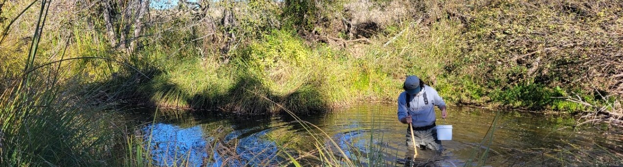
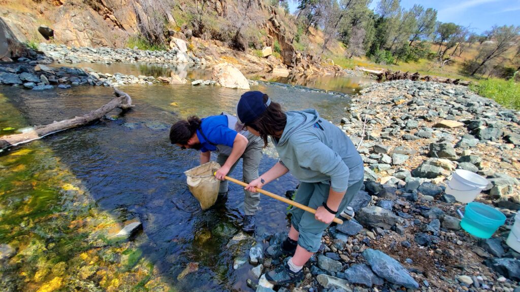
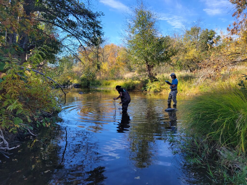
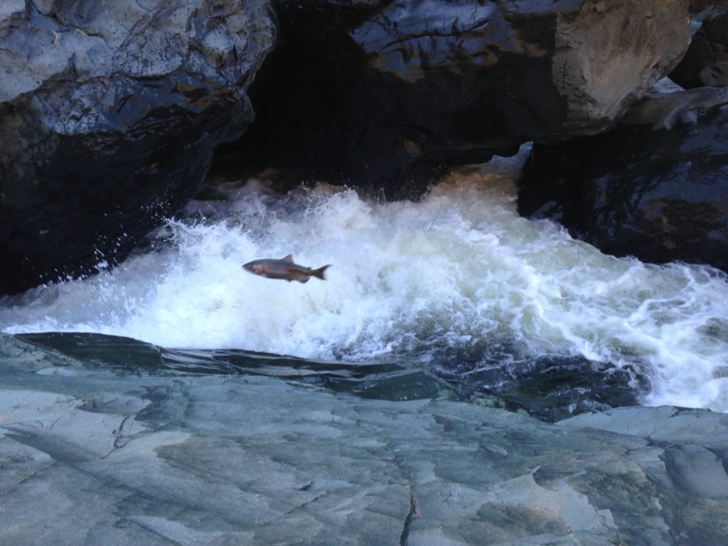
Sierra Streams Institute is undertaking a restoration project to supplement, improve and maintain salmonid habitat along a portion of Dry Creek within Beale Air Force Base, Yuba County, CA. This is an exciting project for SSI because all programs have an opportunity to work together on one project to monitor water quality, provide trail-side educational resources, develop a volunteer / stewardship relationship with the community on base, and provide research-level data about new approaches to restoration.
The History
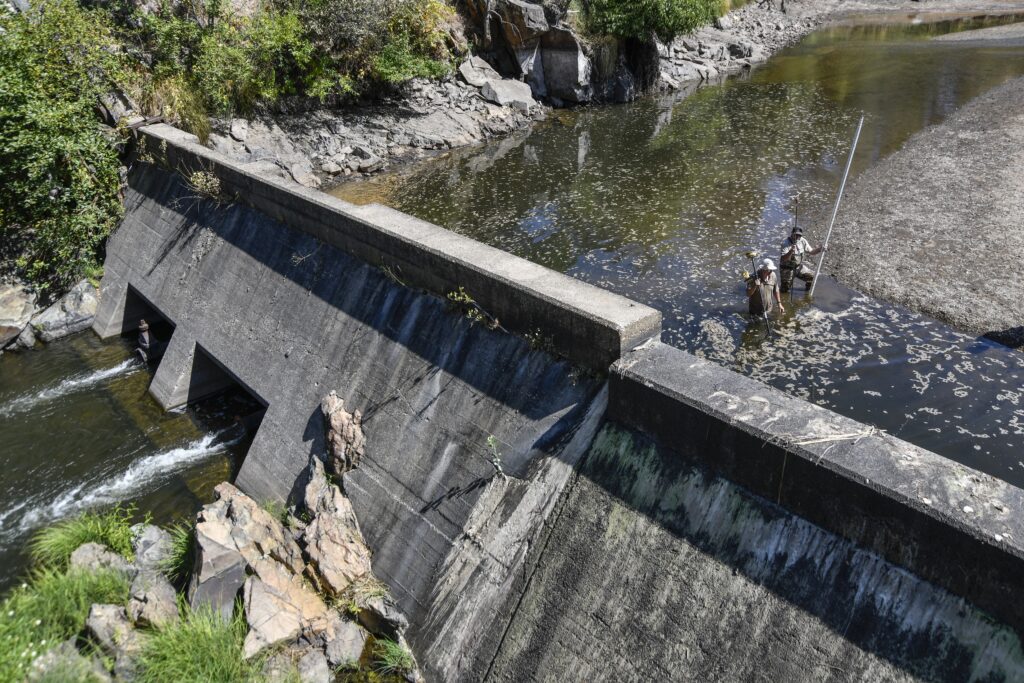
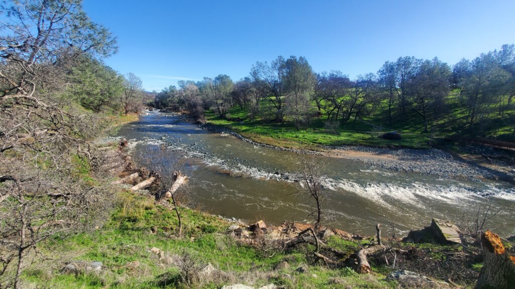
In the early 1940’s a 15 foot dam was constructed on Dry Creek causing a small lake to form and restricting the migration of Chinook Salmon and Central Valley Steelhead. The dam stood for nearly 80 years until it was removed in 2020 via a collaboration between the U.S. Fish & Wildlife Service and the United States Air Force. Following the dam removal, restoration of the old lake bed was carried out by reinforcing the streambed and banks with imported rock, placing root-wads to prevent erosion and shade the creek, and carving out a low-flow channel to allow fish to travel even during minimal summer flows.
Current Happenings
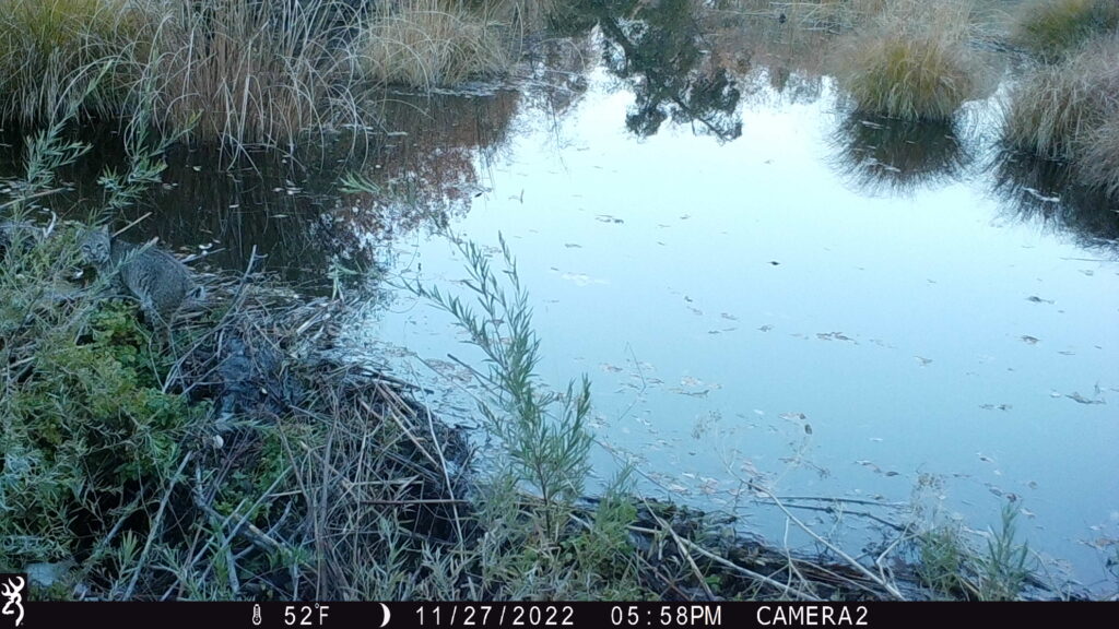
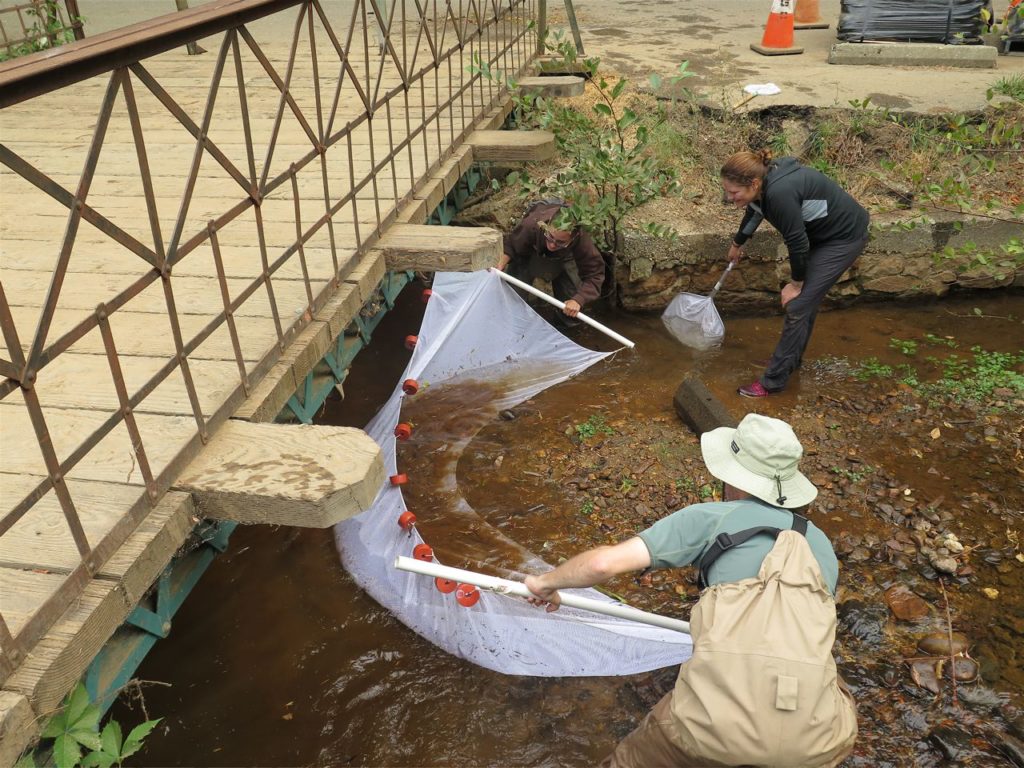
- Since 2021, Sierra Streams Institute has been performing regular monitoring and maintenance of the Beale Lake dam removal restoration area including water quality monitoring, benthic macroinvertebrate (BMI) research, spring bird surveys, yearly physical habitat surveys, year-round wildlife monitoring, stream flow and height monitoring, and more.
- In addition to monitoring, we’re focusing our efforts on native plant propagation from locally collected seed grown in our own greenhouse alongside routine invasive plant species removal with the hopes of establishing a diverse array of native species for wildlife habitat, forage, and pollinators.
- Starting in the spring 2024, we will break ground on a nature trail, connecting the Beale Air Force Base community with Dry Creek and the natural spaces around them. The trail will include educational signage that delves into topics such as the importance of beavers, the salmon lifecycle, and oak woodland ecology.
Dry Creek Gravel Augmentation for Salmon Spawning Habitat
In Fall 2023, with funding from the Sutter Buttes Regional Land Trust, Sierra Streams Institute has begun implementing a gravel augmentation project on Dry Creek. These gravels are the specific sizes that native Chinook Salmon will use for laying eggs.
In November 2023 250 tons of varying sized gravel were laid out along the creek banks. During high winter flows, these rocks are carried downstream and spread out naturally.
In order to understand how these rocks move down Dry Creek, a small subset of rocks have been painted with non-toxic, waterproof paint and will be monitored and mapped at regular intervals. This data will help provide insight into how we can implement gravel augmentation projects more effectively in systems like Dry Creek going forward.
The Sierra Foothills Forest and Climate Resilience Implementation Project
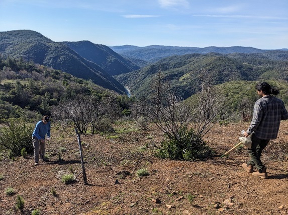
facing the South Yuba River
Funded by the Wildlife Conservation Board from October 2023 to March 2027, with fiscal sponsorship through Nevada County (OES)
The Project will improve forest health and reduce catastrophic wildfire risk using climate-smart management practices across multiple private and Federal parcels in rural Nevada City, California. The project area consists of the Jones Bar FireWise Community, BLM land, and three Outdoor Schools: Shady Creek, Nevada City School of the Arts (NCSA), and Camp Woolman. 625 acres will be treated across the project area, with several community events, including:
- A Biochar workshop on the Woolman property for the community to participate and learn about what biochar is, how to make it, and how it is beneficial for the environment
- A controlled burn event on the Woolman property for the community to learn about prescribed fire and to observe the site before and after the burn
- A separate post-treatment site walk at the Woolman school
- Opportunities for the public to assist with controlled burns on private parcels in the Jones Bar FireWise Community
- Nevada City School of the Arts students are collecting pre and post scotch broom data on their campus
- Community meetings with Nevada County OES, including a SimTable demonstration showcasing the benefit of multiple projects that tie together to improve wildfire resiliency
Ecosystem benefits through this project include forest health improvement and development of climate refugia, low-intensity fire return, improved native species diversity, and watershed protection, all with an emphasis on community engagement!
Looking to improve your own property? Read the Resource Toolkit for Landscape-Scale Management in Western Nevada County here.
Forest Management Plans and Project Map
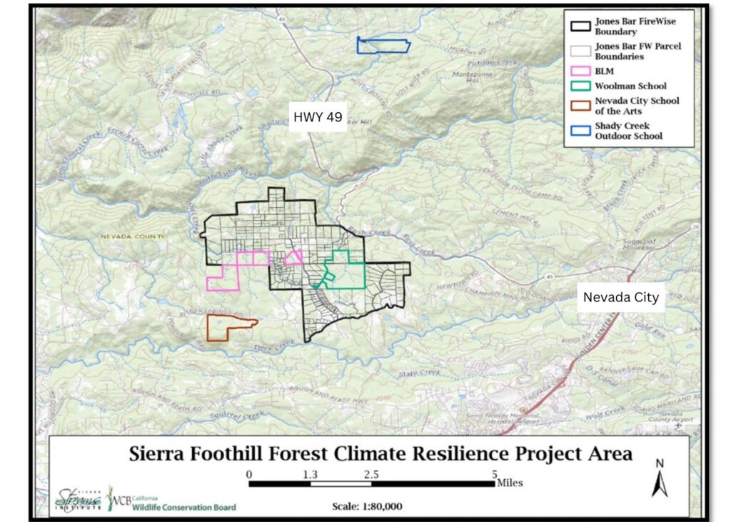
Read the Forest Management Plans for each area by clicking on the links below.
Previous Projects
Salmon and Steelhead Habitat Restoration
Deer Creek is the last tributary on the Yuba before upriver passage is blocked by Englebright Dam. Therefore, the mouth of Deer Creek at the confluence with the Yuba River provides spawning and rearing habitat for Central Valley Chinook salmon and steelhead. Salmon and steelhead were present at the mouth of Deer Creek in large numbers in the early part of the 20th century. Human activity, including dams, development, agriculture, and water diversions, have resulted in a decline in the amount of suitable spawning habitat. Sierra Streams is engaged in longterm efforts to restore critical habitat through a combination of approaches, including riparian native revegetation, targeted invasive species removal, regularly repeated gravel injections, spawning bed enhancement, and modifications to the management of the watershed. Our efforts are part of a regional effort to reverse decades of steep decline in anadromous fish populations.
Hirschman’s Pond Forest Health Project
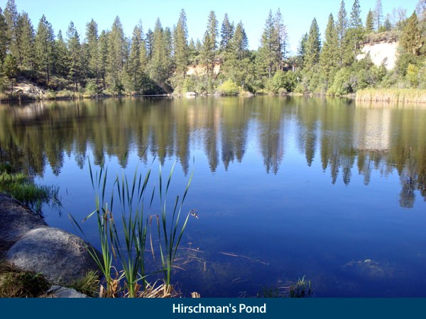
The goals of this project were to improve forest health by reducing dense overstocked trees and invasive plants, help prevent catastrophic wildfire and impacts to water quality and wildlife habitat, and protect the community.
We reduced fuel loads through selective thinning of trees less than 6 inches in diameter, flammable understory vegetation, dead and downed material, and invasive species such as Scotch broom, in order to promote healthier forest conditions. Trees including black oak, madrone, and buckeye were protected to provide diversity and wildlife habitat for species such as Western pond turtles, Pacific chorus frogs, songbirds and waterfowl. This project was completed in December 2019, with the help of professional and volunteer trail crews.
Abandoned Mine Remediation
Under grants received by the City of Nevada City, Sierra Streams Institute conducted a Brownfields Community-Wide Assessment of abandoned mine sites on properties owned by the City of Nevada City. SSI took soil samples from four sites: Pioneer Park, Stiles Mill, Hirschman’s Pond, and Providence Mine. All of these high-use sites had areas with suspected mine waste. SSI tested soil samples for heavy metals and evaluated the results using EPA human health risk assessment methods. As a result of these assessments SSI has cleaned up two abandoned mine sites and is proceeding with cleanups of two other mine waste sites in Nevada City.
Stiles Mill was cleaned up with an EPA Brownfields Cleanup grant in 2013. A new trail was constructed to the site from Clark Street which may one day lead to a foot bridge across Deer Creek.
Providence Mine was cleaned up in 2014 and 2015 with funding from two EPA Brownfields Cleanup grants and a Sierra Nevada Conservancy Assessment and Cleanup Grant. Visitors can now access the site by taking the Providence Mine Spur Trail from the Deer Creek Tribute Trail at the west end of Nevada City’s Environs Property.
The Pioneer Park cleanup, funded by a California Department of Water Resources Urban Streams Grant for the the Little Deer Creek Restoration and Flood Mitigation Project, began in 2017. Prior to the in-stream work, SSI caught and temporarily relocated 63 trout with no casualties. An ADA accessible “Roll and Stroll Trail” will be constructed around the perimeter of the park.
SSI is currently working on an EPA Brownfields cleanup of the Providence Quartz Mill located across Providence Mine Road from the Providence Mine site. Stay tuned for details as the cleanup proceeds.