SIERRA STREAMS
Watershed Monitoring, Research, & Restoration
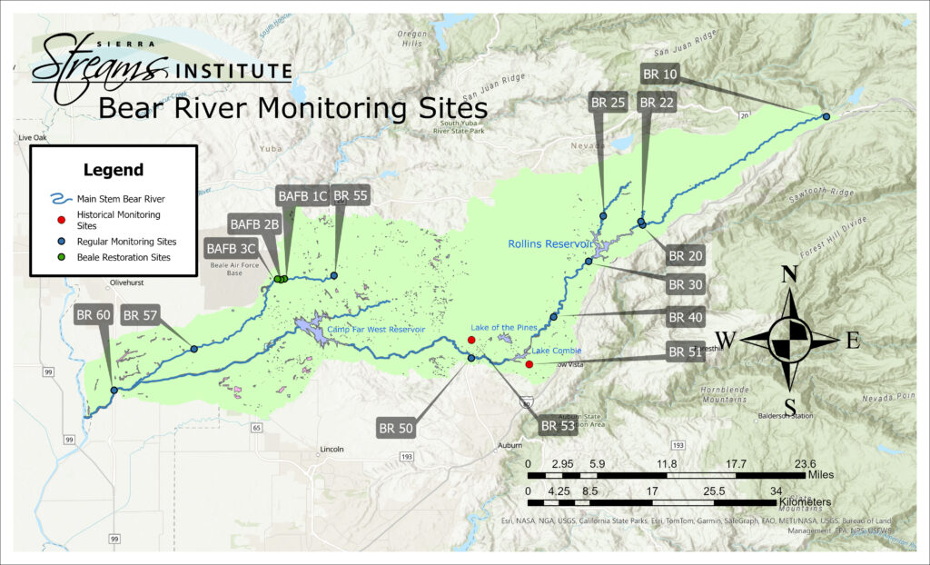
The Bear River is 73 miles long, stretching from just below Lake Spaulding to its confluence with the Feather River. In total, the watershed contains 296,452 acres of land and more than 990 miles of tributaries, including Wolf Creek, which flows through downtown Grass Valley. Like the neighboring Yuba River, the Bear has suffered extensive impacts from its history at the heart of Gold Country, and is one of the most heavily managed watersheds in the state for flow, with numerous dams and diversions. Unlike the Yuba River, however, the Bear has heretofore lacked stewardship and not had the benefit of coordinated planning, monitoring and restoration efforts.
We have been monitoring in the Bear River Watershed since 2016, and our volunteer monitors visit our 10 sites quarterly. Learn more about how you can get involved here.
Sierra Streams Institute established the Bear River Watershed Stakeholder Group with funding from a federal grant from the federal Bureau of Reclamation’s WaterSmart program in 2015.
The Bear River Watershed Group is made up of a variety of individuals and agencies with interests in improving the health of the Bear River watershed. These stakeholders include watershed residents and property owners and representatives of agencies and non-profits.
In 2017:
Since the formation of the stakeholder group, we have:
Click here to access the Bear River Stakeholder Group’s ‘living documents’ including the Disturbance Inventory, Restoration Plan, stakeholder meeting documents, along with 2016 and 2017 Water Quality Reports.