SIERRA STREAMS
Watershed Monitoring, Research, & Restoration
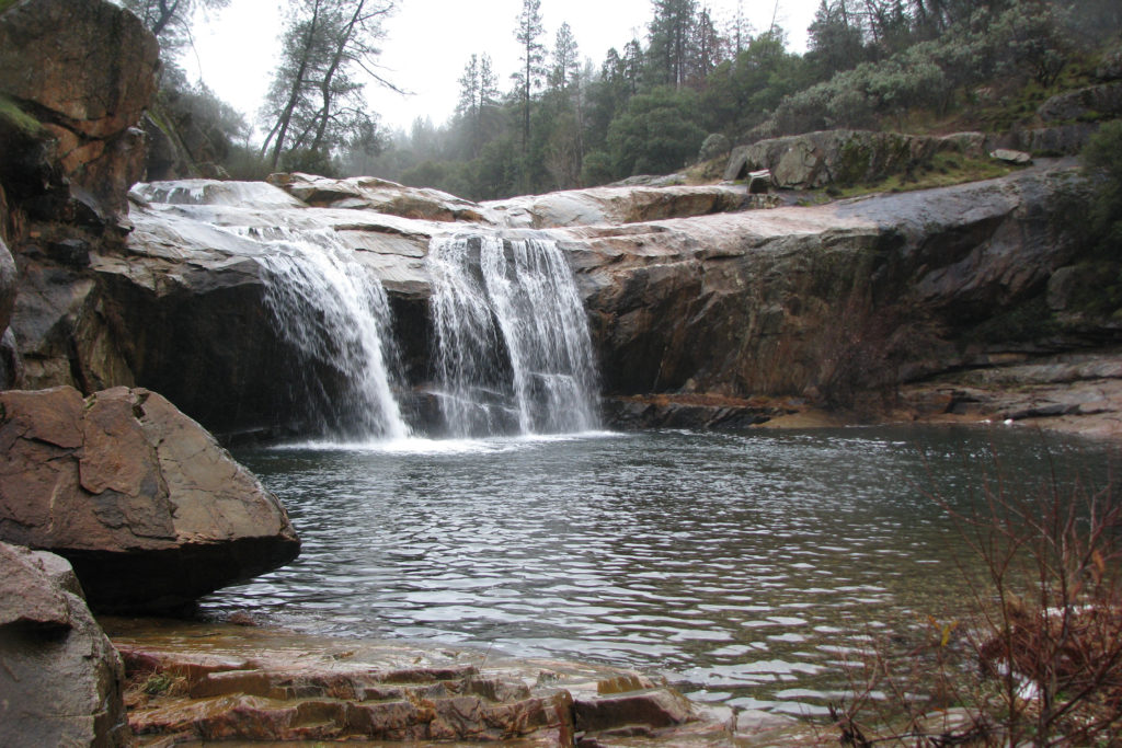
Deer Creek begins as a trickle in the Sierra Nevada foothills, high above Scotts Flat Reservoir at 4000′ elevation. A ribbon of nature, it winds its way through pine forests and alpine meadows, forging canyons and shaping the landscape on its journey downhill. As it rushes through downtown Nevada City, it hosts spawning rainbow and brown trout. Downstream, little known but beautiful, Deer Creek Falls hurries the water towards Lake Wildwood, where residents enjoy swimming and boating. Below the lake, pine forest gives way to willow and oak, and the creek teems with beaver, river otter, eagles, and great blue herons. At 600′ elevation and 34 miles from its source, Deer Creek joins the Yuba River, where it greets the native salmon spawn each fall.
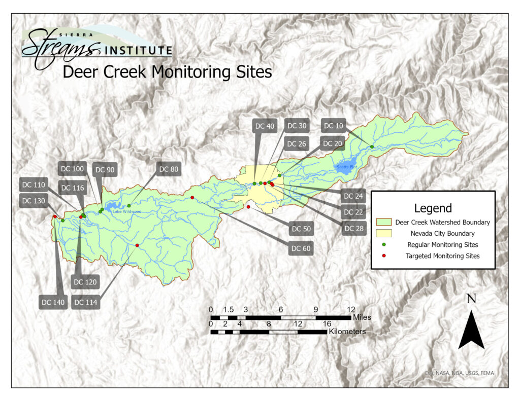
Sierra Streams Institute coordinates a community-volunteer-based Water Quality Monitoring program on the Deer Creek Watershed, where we have been collecting data for more than 20 years. Once per quarter our monitors measure dissolved oxygen, turbidity, pH, conductivity, water temperature, air temperature, nitrate, phosphate, and bacteria (total coliform and E. coli) at 9 “sentinel” sites along Deer Creek and its tributaries. These are the sites where we can keep watch over the watershed, and can investigate additional sites if we pick up something unusual during routine monitoring of a sentinel site. We also check how the creek is doing during storms, as well as during the hottest part of the summer, collecting the same data as above. Additionally, in June and October, community members along with SSI staff collect benthic macroinvertebrates (BMI) samples at most of these monitoring locations. These samples are then identified by volunteers in our Bug Lab.
Learn more about how you can get involved here.