Faucherie Dam, Photo Credit: Nevada Irrigation District
As you may have heard, this last winter was a rough one for some of Pacific Gas and Electric’s infrastructure, and the Nevada Irrigation District has had to scramble to continue getting water to their customers. You can read more about the details here and here, but the bottom line is that Spaulding Powerhouse 1 is offline until it’s repaired, and in addition a section of the South Yuba pipeline was taken out by a landslide. The result is that NID has been cut off from their water source, with longer repair timelines than anyone would like.
Water sharing between the Yuba River and the Bear River is quite complex, and much of that complexity is about generating power or shifting water to different systems for irrigation. In fact, some consider the water infrastructure of the Spaulding-Yuba-Deer Creek-Bear system to be the most complex in the nation! Why so complicated? Our history of gold mining, of course! When rich deposits of gold were discovered on Deer Creek, miners realized the potential to strike it rich by shifting more water into the Deer Creek system.
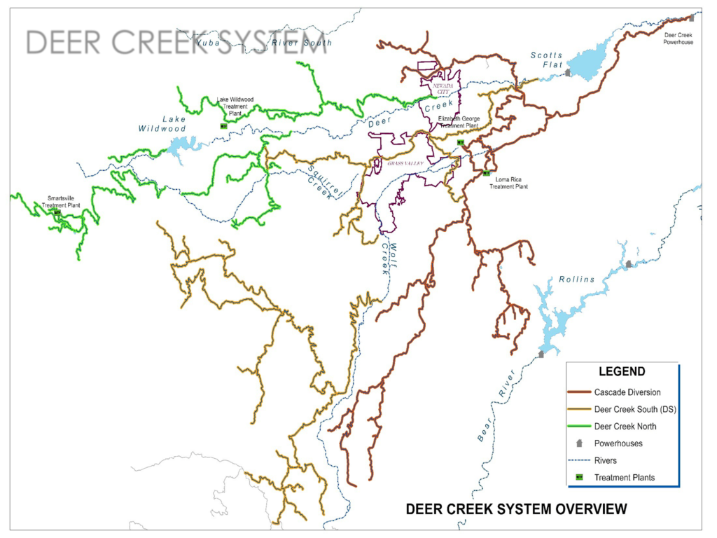
Impacted Watersheds
These damages mean that all the snowmelt from the Middle and South Forks of the Yuba River are not being shared with Bear River and Deer Creek, as has been done for the last 100+ years. This means that we will be seeing high flows in the Yuba for longer than we’re used to, and lower flows in Deer Creek and the Bear River than we’re used to seeing, with the potential for drying up in the late summer. This may seem strange but it is actually the “natural” way it used to be! Historically, with its relatively low elevation headwaters, Deer Creek likely ran dry some years, but this was obviously before a small city was built that depends on that water!
The damages outlined above are actually two or even “three or four” different, but somewhat related, problems, according to Greg Jones, Interim Manager of NID. As has been covered by YubaNet and other sources regionally, the damage to the South Yuba Canal means no water can take that normally used route to supplement Deer Creek flows. However, this doesn’t mean that all flow to Deer Creek is cut off. According to Mr. Jones, there is another spillover point where water can be allocated to Deer Creek further down the Bear River canal. This issue with that, however, comes back to the damage at the powerhouse itself and how much flow can be released into the canal itself.
The most recent projections from PG&E would see the Spaulding Powerhouse partially repaired by June 15, which would allow NID and Placer County Water Agency to get about half of the water that they’re used to receiving during that time of year, with “a portion” of that flow still allocated to Deer Creek as needed, while repairs to the South Yuba Canal may not take place into fall, winter, or later.
We just had a great water year, why are we being asked to conserve water?
According to NID comments, the most highly impacted water resources will likely be for irrigation. You may have seen signs to voluntarily conserve water, and the amount of conservation may still change depending on how repairs go. It is true that we’ve had a “good” (in fact, around average or above average) water year. This means that currently, snowmelt is still providing plenty of runoff, and reservoirs are mostly full, but this is expected to shift rapidly as dependence shifts from fresh snowmelt to stored water being released from Spaulding and the damaged infrastructure, a lot of which has now simply been released into the South Yuba instead of stored and released into the Bear River and Deer Creek.
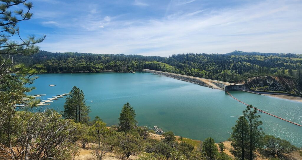
Rollins Reservoir. NID is doing photo monitoring to show the public how rapidly the reservoir can drop without water input from the upper canal system. Photo Credit: Nevada Irrigation District
What about other impacts to Deer Creek? How can I help monitor?
We at SSI will be documenting what flow looks like in Deer Creek and Bear River this year, and we need your help! We do quarterly water quality monitoring at multiple sites in both watersheds, and also do “bioassessment”, using in-stream biological samples to inform our understanding of stream health and impacts from things like climate change and land use. From a scientific perspective, we can almost view this year’s issues as an “artificial” drought, but with a return to somewhat “natural” flows as they were before we built all of Deer Creek’s water infrastructure. Studying how the stream responds in years like this, along with our 25 years of historical data, allow us to build models of stream response to predicted extreme drought in the future. So we’re using this as a scientific opportunity!
There are two ways you can help:
- Join our monitoring teams and help us sample this year! Our next major sampling dates are in June, and we are always looking for more crew members! Come volunteer to keep an eye on our streams this year. For more information, see here.
- Join our new flow monitoring community science program, which is as easy as taking a picture on your phone and using our new form! Take pictures of the creek and add them to our database here. The form will ask to record your location so that we can accurately put your photo on a map; if you are uploading later and are no longer at the creek, just describe where you were in the notes section. All of our photos and observations will be posted to a map on our website and our monitoring dashboard.
The unique situation we find ourselves in may be difficult to understand if you haven’t dived in to figure out what’s going on. NID has been keeping the public informed via a page on their website here, and will also be talking at SSI’s next SciPub at Gold Vibe Kombuchery (Tuesday May 28 at 6pm). We hope to see you there to discuss this issue more, and share how to use our monitoring app!